Welcome,
Guest! Login
Login
0 Items
$0.00
$0.00

Login to enter your own
review of this item.
 cjpeng00 Gmap has been selling unique items on Atomic Mall since September of 2012. We are located in Stouffville On, and we'd love
to welcome you to our store! At cjpeng00 Gmap, the customer is always priority #1.
cjpeng00 Gmap has been selling unique items on Atomic Mall since September of 2012. We are located in Stouffville On, and we'd love
to welcome you to our store! At cjpeng00 Gmap, the customer is always priority #1. 
Center total is the Seller's overall score, averaged from each active component:
|
Atomic Mall Feedback: Imported Feedback: Order Fulfillment Rate: |
100.0 100 100 | |
| Trophies Earned | ||
|
|

ALL OFFERS are Welcome ! Just feel free to make me OFFER !
OR you can direct ADD-TO-CART with this amazing Fair Price for saving your time
FREE SHIPPING to ANYWHERE in the world via standard mail service to your PAYPAL address
Also Packaged with BUBBLE ENVELOPE, and therefore keeps your item in SAFE.
We will mail your item within 24hrs after payment received.
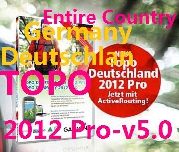
Format: MicroSD'/SD' card
Version: 2012.00
Released: May, 2012
Part Number: 010-11288-00
You even do not need unlock this map, just plug it into your Garmin device when needed
100% Working Perfect - Money Back Guarantee!!!
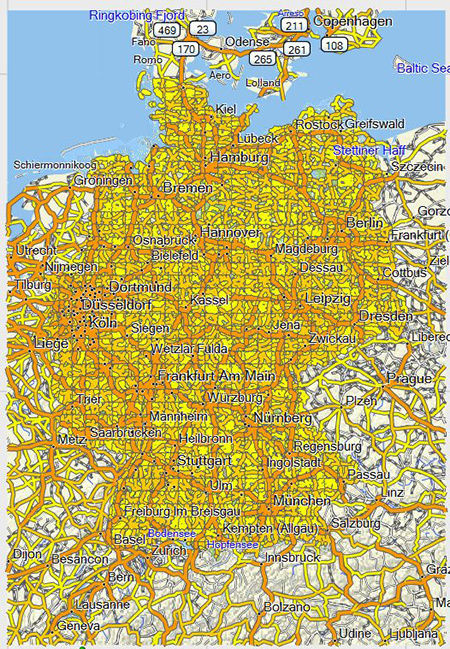
Provides precise topographic maps in reference scale of 1:25.000
Includes enhanced recreation trail network as well as detailed hiking trail network for touristic regions and long-distance hiking trail network (national level)
Provides detailed cycling network and long distance cycling network
Contains detailed path information for small paths, hiking trails and the whole traffic network.
Displays land use such as forests, lakes, streams and mountains.
Offers ActiveRouting , allowing you to customize and specifically plan routes for the entire road and trail network. The activity-specific map displays highlights of suggested routes in addition to dedicated biking and hiking routes
Includes searchable street names and points of interest for recreational activities and traveling.
About Coverage
Features digital topographic vector maps for all of Germany.
Let us guide you on all of your recreational and outdoor adventures in Germany, from the shores of the North Sea up to the summits of the Alps. This mapping product comes with new and helpful information, such as single house display and a lot of natural and cultural sites.
Provides precise topographic maps in reference scale of 1:25.000
Includes enhanced recreation trail network as well as detailed hiking trail network for touristic regions and long-distance hiking trail network (national level)
Provides detailed cycling network and long distance cycling network
Contains detailed path information for small paths, hiking trails and the whole traffic network.
Displays land use such as forests, lakes, streams and mountains.
Includes searchable street names and points of interest for recreational activities and traveling.
Features digital topographic vector maps for all of Germany.
View microSD'/SD' card-compatible products
|
|
|