The Historical Archive is dedicated to creating a large, robust library of DVD and CD based products covering a wide range of significant and interesting historical events and cultural moments through film, photos, audios, maps and other documents. This growing collection of unique, special interest DVDs and CDs covers the full range of significant events that have shaped our culture, entertainment values and history.
Due to the unique nature and low volume sales of many of our titles, we utilize publish on demand technologies [DVD-R/CD-R] to guarantee delivery of a high quality product at the time of order - ensuring that all orders are fulfilled in a timely manner.
All orders are shipped within two business days via first class mail/international air mail.
0 units sold
No product attributes have been entered for this item.
No warranty info available for this item.
We offer a 30 day no questions asked refund policy on all our CDs and DVDs. If the product is returned within 30 days, a full refund of the purchase price will be issued provided there is no damage to the product - which includes scratches, fingerprints, etc, on the disks. In that instance, we reserve the right to charge a 20% restocking fee. S&H is not refundable.
Description
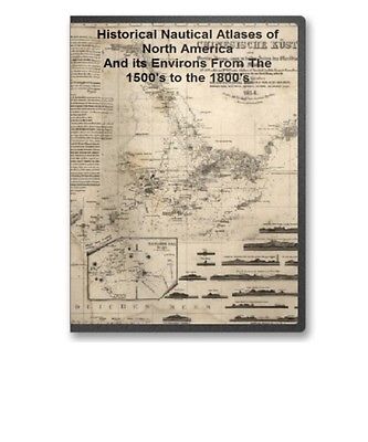
The Historical Archive Sample Page 71 Rare Historical Nautical Atlases of North America And its Environs From The 1500's to the 1800's on CD
This CD contains 71 rare antique nautical maps in MrSid format. This format allows you to see the entire map on your computer screen or drill down to see the smallest details. The original maps are often quite large, as much as 36" long or larger and quite detailed. With the MrSID software, you can manipulate the map to print the entire map in great detail or zoom into a portion of the map in full detail for viewing or printing. You could even bring the images to a local print shop to have the maps reprinted in their full size. (MrSID software is included on the CD.)
To give you a sample of the detail you can expect in these maps, here is an example based on a panoramic map of Washington, DC.
The table below shows the and a small image of each map on this incredible natutical history map collection CD.
Map of the northeast coast of North America, 1607, drawn by Samuel de Champlain Champlain, Samuel de, 1567-1635. NOTES Covers the coast of North America from western Nova Scotia to Cape Cod. Pictorial map. Original title: Descripsion des costs, pts., rades, illes de la Nouuele France faict selon son vray m ridien : avec la d clinaison de la ment de plussieurs endrois selon que le sieur de Castes le franc le d montre en son liure de la m com trie de l'emnt. / faict et observ par le sr. de Champlain 1607. A new and correct chart of North America from Cape-Cod, to the Havannah; drawn from the latest marine journals & surveys, regulated and ascertained by astronomical observations. Moore, John Hamilton, d. 1807. CREATED/PUBLISHED London; Printed for and sold by J. H. Moore and G. Robinson, bookseller, 1784. NOTES Scale ca. 1:1,250,000. Depths shown by soundings. Descripcion de la costa de Tierra Firme desde el Rio de la Empalizada hasta Cavo de Clara. Por las latitudes y longitudes de Dn. Bartolome de Rosa. Echo por Balentin Cierto primer Piloto de la Real Armada, a o de 1757. Cierto, Balentin. CREATED/PUBLISHED 1757 NOTES Scale ca. 1:3,300,000. Title on verso: Florida & Cuba, 140. Manuscript, pen-and-ink, on tracing paper. Soundings shown in fathoms. Prime meridian: Ferro. Shows Cuba, Bahama Islands, northern Yucatan Peninsula, and the coast of the United States from "Cape Clara" to the mouth of the Mississippi River. General chart of the coast. No. IV, from Cape May to Cape Henry. From a trigonometrical survey under the direction of F. R. Hassler and A. D. Bache, Superintendents of the survey of the coast of the United States. United States Coast Survey. CREATED/PUBLISHED Washington U.S. Coast Survey 1862. NOTES Scale 1:400,000. Portolan chart of the Mediterranean Sea ca. 1320-1350. CREATED/PUBLISHED 13--? NOTES Anonymous nautical chart in portolan style probably drawn in Genoa. Covers Mediterranean Sea from the Balearic Islands to the Levantine coast; also covers western part of Black Sea. Mapa maritimo del Golfo de Mexico e islas de la America, para el uso de los navegantes en esta parte del mundo, construido sobre las mexores memorias, y observaciones astronomicas de longitudes, y latitudes. Dedicado a la Catholica Magestad de Don Fernando VI Rey de Espa a, y de las Yndias, por sus mas rendidos, y fieles vasallos, Thomas Lopez, y Juan de la Cruz. L pez de Vargas Machuca, Tom s, 1731-1802. CREATED/PUBLISHED Madrid 1755. NOTES Scale ca. 1:5,500,000. Depths shown by soundings. Descripcion de las costas, islas placeres, i bajos delas, Indias Occidentales, corregida i calculada al meridiano dela isla de Theneriphe enlas Canarias por Pedro Alcantara Espinosa, Campeche i Abril 10 de 1765. Espinosa, Pedro Alcantara. CREATED/PUBLISHED 1765 NOTES Scale ca. 1:5,000,000. Manuscript, pen-and-ink and watercolor, on vellum. Shows the Atlantic coast of southern U.S., Mexico, Central America, and northern South America. Mapa y plano del Seno Mexicano. Contodas las costas, de tierra firme e yslas de barlovento consus adyacentes, recopiladas, sus-latitudes y longitudes en el puerto de la Havana con junta de primeros y segdos. pilotos de la esquadra y segun el neuvo padron; por Dn. Josef de Sn. Martin Suares, theniente de navio de la Real Armada, Ayudante y primer piloto mayor de Derrotas, celebrada por disposicion del, Exmo Sor. Dn. Josef Solano y Bote, caballero ... Delineado, en Cadiz por Dn. Josef Dias Portaly. A o de 1787. San Mart n Su rez, Jos de. CREATED/PUBLISHED n.p., 1787 NOTES Scale ca. 1:3,250,000. Depths shown by soundings. Shows coasts of southern United States, eastern Mexico, eastern Central America, northern South America, and West Indies. Includes tables of "Nombres de los cayos del canal viejo" and "Nombres de los cayos del nte. de la Havana." Chesapeake Bay from its head to Potamac River From a trigonometrical survey under the direction of F. R. Hassler and A. D. Bache, Superintendents of the survey of the coast of the United States. United States Coast Survey. CREATED/PUBLISHED Washington U.S. Coast Survey 1861-1862. NOTES Scale 1:80,000. From its Report of the Superintendent of the Coast Survey, showing the progress of the survey during the year 1864 (Washington, Government Printing Office, 1866). Chesapeak Bay. Sheet 6, from the mouth of York River to the entrance to bay. From a trigonometrical survey under the direction of A. D. Bache, Superintendent of the survey of the coast of the United States. Triangulation by E. Blunt & J. Farley, Assistants. Topography by J. J. S. Hassler, G. D. Wise, J. Seib, Assts. & J. Mechan, Sub-Asst. Hydrography by the party under the command of Lieut. Comdg. J. J. Almy, U.S.N. Assistant. United States Coast Survey. CREATED/PUBLISHED Washington U.S U.S. Coast Survey 1863. NOTES Scale 1:80,000. From its Report of the Superintendent of the Coast Survey showing the progress of the survey during the year 1862 (Washington, Government Printing Office, 1864). Chesapeake Bay, Sheet no. 1, York River, Hampton Roads, Chesapeake entrance.. From a trigonometrical survey under the direction of A. D. Bache, Superintendent of the survey of the coast of the United States. Triangulation by E. Blunt & J. Farley, Assistants. Topography by J. J. S. Hassler, G. D. Wise, J. Seib, Assts. & J. Mechan, Sub-Asst. Hydrography by the party under the command of Lieut. Comdg. J. J. Almy, U.S.N. Assistant. Redd. drng. by W. M. C. Fairfax, A. Strausz & L. D. Williams. Engd. by J. Knight, A. Sengteller, H. S. Barnard & J. C. United States Coast Survey. CREATED/PUBLISHED Washington U.S. Coast Survey 1863. NOTES Scale 1:80,000. Kondrup. Die Chinesische K 1/4ste : der Provinz Kuang-tung, zu beiden Seiten des Meridians von Macao. Berghaus, Heinrich Karl Wilhelm, 1797-1884. OTHER TITLES Provinz Kuang-tung, zu beiden Seiten des Meridians von Macao CREATED/PUBLISHED Gotha : Justus Perthes, 1834. NOTES Depth shown by soundings and hachures. A Sketch of the harbour of St. Iago de Cuba. CREATED/PUBLISHED 1765? NOTES Scale ca. 1:15,500. Soundings shown in fathoms. Plano de la Bahia de la Ware y entrada de Filadelfie. Campo, Josef del. CREATED/PUBLISHED 178-? NOTES Scale ca. 1:200,000. Soundings shown in fathoms. Descripcion de la Bahia de Santa Maria de Galve, y Puerto de Sn. Miguel de Panzacola con toda la costa contigua y las demas bahias que tiene en ella, hasta el Rio de Apalache / observada, y reconozida por los ingenieros Dn. Jaime Lajonk, y Don Juan de Siscara. Lajonk, Jaime. CREATED/PUBLISHED 1700. NOTES Covers coast of western Florida Panhandle from Pensacola to Apalachicola. Depths shown by soundings. A of the sea coasts ... in the East Indies / by William Hacke. Hacke, William. OTHER TITLES Hack's descript of ye East Indies Title also known as: Buccaneer atlas CREATED/PUBLISHED 1690? NOTES Covers the coasts of eastern Africa, India, and the East Indies. Relief shown pictorially. Each drawing bears a brief with soundings, distances and facts regarding anchorages and navigation of rivers which might be of value in pirating activities. This atlas is known as the "Buccaneer atlas" because it results from the experience of Hacke in association with Captain Bartholomew Sharpe, the notorious Buccaneer on various expeditions to the South Sea. L'hydrographie fran oise : recueil des cartes g n rales et particuli res qui ont te faites pour le service des vaisseaux du roy, par ordre des Ministres de la marine, depuis 1737, jusqu'en. Bellin, Jacques Nicolas, 1703-1772. CREATED/PUBLISHED Paris, 1737-72 1765. A map with part of the Florida coast from Cape Blaise to Apalachie; with the boundaries betwixt East & West Floridas, 160 yards across the river call'd Apalachicola. Robt. Slowley of Hs. Ms. sloop Druid, fecit September the 4th, 1769. Slowley, Robert. CREATED/PUBLISHED 1769 NOTES Scale ca. 1:205,000. Depths shown by soundings. Maps of East and West Florida. B. Romans, inv. delin. & in re incidit. Romans, Bernard, ca. 1720-ca. 1784. CREATED/PUBLISHED New York, 1781 NOTES Scale ca. 1:500,000. Cover title. Alternate title from Peter Force's catalog of printed maps: Florida and its vicinity. Relief shown by hachures. Depths shown by soundings. Coast of Maine from Frenchman Bay to Mosquito Harbor.Des Barres, Joseph F. W. (Joseph Frederick Wallet), 1722-1824. CREATED/PUBLISHED London 1776. NOTES Scale ca. 1:130,000. Hand colored. Relief shown by hachures. Coast of Maine from Salter Island to Portland Head.Des Barres, Joseph F. W. (Joseph Frederick Wallet), 1722-1824. CREATED/PUBLISHED London I. F. W. Des Barres, 1776. NOTES Scale ca. 1:48,000. Relief shown by hachures and shading. Soundings shown in feet. Coast of New England from Cape Elizabeth, Me. to Newburyport, Mass. Des Barres, Joseph F. W. (Joseph Frederick Wallet), 1722-1824. CREATED/PUBLISHED London 1776. NOTES Scale ca. 1:130,000. Relief shown by hachures. Coast of Maine showing Blue Hill Bay, Penobscot Bay, Belfast Bay, Islesboro Island, Deer Island, and other islands. Des Barres, Joseph F. W. (Joseph Frederick Wallet) 1722-1824. CREATED/PUBLISHED London, 1776? NOTES Scale ca. 1:48,500. Relief shown by hachures. Depths shown by soundings. Coast of Maine showing entrances of Blue Hill Bay, Isle of Haut Bay, and Penobscot Bay, with Owls Head, Vinalhaven Island, Isle au Haut, and other islands. Des Barres, Joseph F. W. (Joseph Frederick Wallet) 1722-1824. CREATED/PUBLISHED London, 1776? NOTES Scale ca. 1:48,500. Relief shown by hachures. Depths shown by soundings. Coast of Maine showing entrances of Blue Hill Bay, Isle of Haut Bay, and Penobscot Bay, with Owls Head, Vinalhaven Island, Isle au Haut, and other islands. Des Barres, Joseph F. W. (Joseph Frederick Wallet) 1722-1824. CREATED/PUBLISHED London, 1776? NOTES Scale ca. 1:48,500. Relief shown by hachures. Depths shown by soundings. Coast of New England from Chatham Harbor to Narragansett Bay. Des Barres, Joseph F. W. (Joseph Frederick Wallet), 1722-1824. CREATED/PUBLISHED London 1779. NOTES Scale ca. 1:130,000. Depths shown by soundings. Cedar Keys, Florida From a trigonometrical survey under the direction of A. D. Bache, Superintendent of the survey of the coast of the United States. Triangulation by F. H. Gerdes, Asst. and B. Huger Jr., Sub-Assist. Topography by F. H. Gerdes, Asst. Hydrography by the parties under the command of Lieuts. Comdg. O. H. Berryman & J. J. Guthrie, U.S.N. Assts. Redd. drng by A. Schoepf and A. Strauss sic . engd. by W. Langran and F. Bartle. Lith. of C. Knickerbocker, Albany, N.Y. Preliminary chart of Escambia and Santa Maria de Galvaez i.e., East Bays, Florida From a trigonometrical survey under the direction of A. D. Bache, Superintendent of the survey of the coast of the United States. Triangulation and topography by F. H. Gerdes, Asst. Hydrography by the party under the command of Lieut. Comdg. T. S. Phelps. U.S.N. Assist. United States Coast Survey. CREATED/PUBLISHED Washington, U.S. Coast Survey , 1861. NOTES Scale 1:30,000. United States Coast Survey, no. 489. General chart showing soundings and coast vegetation. Chart is based on "long itude east from Public Square, Pensacola." Preliminary edition of general chart of the coast no. X, Sraits of Florida from Key Biscayne to Marquesas Keys From a trigonometrical survey under the direction of A. D. Bache, Superintendent of the survey of the coast of the United States. United States Coast Survey. CREATED/PUBLISHED Washington, U.S. Coast Survey, 1862 NOTES Scale 1:400,000. Preliminary coast chart ... Florida Reefs on four sheets From a trigonometrical survey under the direction of A. D. Bache, Superintendent of the survey of the coast of the United States. United States Coast Survey. CREATED/PUBLISHED Washington, U.S. Coast Survey, 1864 NOTES Scale 1:80,000. Key West harbor and its approaches. From a trigonometrical survey under the direction of A. D. Bache, Superintendent of the survey of the coast of the United States. Triangulation by J. E. Hilgard, Assistant. Topography by L. H. Adams, Sub-Asst. Hydrography by the party under the command of Lieut. John Rodgers, U.S. Navy Assistant. Redd. drng. by E. K. Knorr. Engd. by E. Yeager, E. F. Woodward, and H. M. Knight. Published 1855. United States Coast Survey. CREATED/PUBLISHED Washington, U.S. Coast Survey , 1864. NOTES Scale 1:50,000. Plano de la bahia de Pansacola. Copiado pr. el pilotin del No. Dn. Josef Magule bajo la correccion del Alf rez de frag a ta Dn. Pedro Rivelles, mro. delineador por S. M. del Departam en to de Cadiz su original levantado el a o de 82, por Dn. Antonio Donato Paredes. Paredes, Antonio Donato. CREATED/PUBLISHED 1782 NOTES Scale ca. 1:60,000. Watermark: Zoonen. Relief shown pictorially. Depths shown by soundings. Gulf coast of the United States, Key West to Rio Grande.United States Coast Survey. CREATED/PUBLISHED Washington, U.S. Coast Survey , 1863. NOTES Scale 1:1,200,000. Eastern part Key West to the Mississipi River. --Western Part Mississippi River to Rio Grande Draught of the Bay of Honduras and the Musqueto Shoar. By George Robertson, Master of His Majesty's ship The Prince Edward. Robertson, George, master of H. M. S. Dolphin. CREATED/PUBLISHED 1764 NOTES Scale ca. 1:430,000. Oriented with north to the left. Relief shown pictorially. Depths shown by soundings. A draught of the Bay of Honduras and part of
$
13.45
Listing ID: 3029493
More Items
from The Historical Archive
This site uses cookies to enhance the user experience. By continuing, you agree to their use. More Info
 Login
Login


 The Historical Archive is dedicated to creating a large, robust library of DVD and CD based products covering a wide range of significant and interesting historical events and cultural moments through film, photos, audios, maps and other documents. This growing collection of unique, special interest DVDs and CDs covers the full range of significant events that have shaped our culture, entertainment values and history.


