Welcome,
Guest! Login
Login
0 Items
$0.00
$0.00


Login to enter your own
review of this item.
 The Historical Archive is dedicated to creating a large, robust library of DVD and CD based products covering a wide range of significant and interesting historical events and cultural moments through film, photos, audios, maps and other documents. This growing collection of unique, special interest DVDs and CDs covers the full range of significant events that have shaped our culture, entertainment values and history.
Center total is the Seller's overall score, averaged from each active component:
|
Atomic Mall Feedback: Imported Feedback: Order Fulfillment Rate: |
100.0 99.8 100 | |
| Trophies Earned | ||
|
|

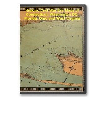
This CD contains 61 rare historic maps and descriptive pages representing fascinating details about Connecticut, Washington DC, Florida, Ohio and West Virginia and its vicinity during the Civil War in MrSid format. This format allows you to see the entire map on your computer screen or drill down to see the smallest details. The original maps are often quite large, as much as 36" long or larger and quite detailed. With the MrSID software, you can manipulate the map to print the entire map in great detail or zoom into a portion of the map in full detail for viewing or printing. You could even bring the images to a local print shop to have the maps reprinted in their full size. (MrSID software is included on the CD.)
To give you a sample of the detail you can expect in these maps, here is an example based on a panoramic map of Washington, DC.
The table below shows the and a small image of each map on this fascinating civil war history CD.
Connecticut
New Haven Harbor Founded upon a trigonometrical survey under the direction of F. R. Hassler, Superintendent of the survey of the coast of the United States. Triangulation by James Ferguson and Edmund Blunt, Assistants. Topography by C. M. Eakin, W. M. Boyce & J. Farley, Assistants. Hydrography by the party under the command of G. S. Blake, Lieut. U.S. Navy. Final reduction for engraving by Jno. B. Gluck, Draughtsman. Engraved by Sherman & Smith, N.Y. Electrotype copy no. 4 by S. Siebert, U.S.C.S. 1846. . United States Coast Survey. CREATED/PUBLISHED Washington, U.S. Coast Survey, 186- NOTES Scale 1:30,000. Harbor chart annotated in red to show the sector of fire for guns situated at Oyster Point and Fort Hale, Connecticut. Information added to chart probably reflects the situation during the Civil War. New Haven Harbor Founded upon a trigonometrical survey under the direction of F. R. Hassler, Superintendent of the survey of the coast of the United States. Triangulation by James Ferguson and Edmund Blunt, Assistants. Topography by C. M. Eakin, W. M. Boyce & J. Farley, Assistants. Hydrography by the party under the command of G. S. Blake, Lieut. U.S. Navy. Final reduction for engraving by Jno. B. Gluck, Draughtsman. Engraved by Sherman & Smith, N.Y. Electrotype copy no. 4 by S. Siebert, U.S.C.S. 1846. . United States Coast Survey. CREATED/PUBLISHED Washington, U.S. Coast Survey, 186- NOTES Scale 1:30,000 . Another copy with annotations. Harbor chart annotated in red to show the number and sectors of fire for guns situated at Oyster Point and Fort Hale, Connecticut. Guns at Oyster Point are numbered 1 to 5 and those at Fort Hale, 1 to 15. Information added to the chart probably reflects the situation during the Civil War.Washington DC
Part of map of portions of the milit'y dept's of Washington, Pennsylvania, Annapolis, and north eastern Virginia / compiled in the Bureau of Topographical Eng'rs, War Department &c. Washington, D.C. Oct. 6th, 1862 ; copied in Engr. Bureau C.S.A. Sept. 6th, 1864 by Wm. L. Sheppard, Dftsmn. ; forwarded to Lieut. Genl. J.A. Early Sept. 6th 1864. . United States. Topographical Bureau. NOTES Relief shown by hachures. Shows Washington D.C. region, including western part of Maryland and northeastern Virginia. Does not show Pennsylvania with the exception of Gettysburg. A map of Fairfax County, and parts of Loudoun and Prince William Counties, Va., and the District of Columbia / copied by J. Paul Hoffmann, Top'l. Office, A.N.Va. ; approved S. Howell Brown, 1st Lt. Engs. Troops, in chg. Topl. Dept. A.N.V., March 29th 1864. . Hoffmann, J. Paul. NOTES Relief show by hachures. Shows western Washington D.C. region, including fortifications and names of some residents. Title derived from Stephenson's Civil War maps, 1989. Part of map of portions of the milit'y dep'ts of Washington, Pennsylvania, Annapolis, and north eastern Virginia / compiled in the Bureau of Topographical Eng'rs, War Department &c., July 1861. . United States. Topographical Bureau. OTHER TITLES Map of portions of the milit'y dep'ts of Washington, Pennsylvania, Annapolis and north eastern Virginia NOTES Relief shown by shading. Shows Washington D.C. region, including western part of Maryland and northeastern Virginia. Does not show Pennsylvania with the exception of Gettysburg. Probable Confederate copy of Bureau of Topographical Engineers original. Distance maps. Map of the Atlantic states, showing 50 mile distances from Washington. Map of the battleground at Manassas showing 5 mile distances from Washington. Map of the Fortress Monroe, showing 1 mile distances from the fortress. . Louis Prang and Company. CREATED/PUBLISHED Boston c1861. NOTES Various scales. Imperfect. Left center portion is missing. Each map indicates forts, towns, railroads, and rivers. Insets: Position of forces at Bull Run. 8 x 8 cm.-Fortress Monroe, Old Point Comfort, Virginia. 8 x 8 cm. Population statistics given in side borders. Map of the seat of war! . Louis Prang and Company. CREATED/PUBLISHED Boston c1861. NOTES Various scales. Containing a map of the vicinity of Washington, Baltimore, Harper's Ferry and Annapolis, with five mile distance lines from Washington. Map showing the railroad routes, coast lines and forts, between Boston and Norfolk harbor; map of Norfolk harbor, Fort Monroe and vicinity, with 1 mile distance lines from Ft. Monroe; Map of the vicinity of Richmond. Small map of the Atlantic states, showing the R.road connections; diagram of the camp at Cairo. Plan of Haper's Ferry! Portraits of Gen. B.F. Butler, the late Col. E. Ellsworth, &c. Map of the seat of war! . Louis Prang and Company. CREATED/PUBLISHED Boston c1861. NOTES Another issue. Various scales. Containing a map of the vicinity of Washington, Baltimore, Harper's Ferry and Annapolis, with five mile distance lines from Washington. Map showing the railroad routes, coast lines and forts, between Boston and Norfolk harbor; map of Norfolk harbor, Fort Monroe and vicinity, with 1 mile distance lines from Ft. Monroe; Map of the vicinity of Richmond. Small map of the Atlantic states, showing the R.road connections; diagram of the camp at Cairo. Plan of Haper's Ferry! Includes portraits of Andrew Jackson and Gen. Winfield Scott rather than those of Gen. B. F. Butler and Col. E. Ellsworth. Topographical map of the District of Columbia / surveyed in the years 1856 '57 '58 & '59 by A. Boschke ; engraved by D. McClelland, Washington, D.C. . Boschke, A. CREATED/PUBLISHED Washington : D. McClelland, Blanchard & Mohun, 1861. NOTES Partial cadastral map showing some householders' names, individual buildings, and vegetation. Relief shown by contours and hachures. Depths shown by contours and soundings. Also covers Virginia shoreline zone. "Entered according to Act of Congress in the year 1861, by D. McClelland, Blanchard & Mohun, Hugh B. Sweeny, and Thos. Blagden, in the Clerks Office of the District Court of the District of Columbia." Oriented with north toward the upper left. Catalogue of points of historic interest : Washington D.C. and metropolitan area / selected and marked by the Committee on Marking Points of Historic Interest for the Thirty-Sixth National Encampment of the Grand Army of the Republic, Washington, 1902. . Grand Army of the Republic. Committee on Marking Points of Historic Interest. CREATED/PUBLISHED Washington? : The Committee, 1902? NOTES Shows Civil War hospitals and fortifications. Panel title. Includes text, directory of committee members, and ill. Descriptive index to points of interest and directories on verso. Map showing location of war-time hospitals -- Map of fortifications and defenses of Washington. Map of fortifications and defenses of Washington. . Hodasevich, R. A. CREATED/PUBLISHED Washington, D.C.? : s.n., 1865? NOTES In left lower margin: Taken from a map issued by the War Department in 1865. Map of the defences of Washington. . CREATED/PUBLISHED Washington, D.C.? : s.n., 1865? NOTES Relief shown by hachures. In lower margin below title: (From Atlas accompanying Official Records). Potomac River (in four sheets): Sheet no. 4, from Indian Head to Georgetown From a trigonometrical survey under the direction of A. D. Bache, Superintendent of the survey of the coast of the United States. Triangulation by A. D. Bache, Supdt., C. Ferguson, C. Hosmer and C. H. Boyd, Sub-Assts. Topography by A. M. Harrison, C. M. Bache, Assts., J. Mechan, C. Hosmer and C. H. Boyd, Sub-Assts. Hydrography by the parties under the command of Lieut. comdr. T. S. Phelps, U.S.N. and C. P. Patterson Assis. Redd. drng. by H. Lindenkohl and L. Karcher. Engd. by A. Maedel and A. Petersen. 1864 . United States Coast Survey. CREATED/PUBLISHED S.l. 1864. NOTES Scale 1:40,000. "No. 391" in upper left corner of map. "Electrotype copy no. 1, by G. Mathiot, U.S.C.S." is printed in the upper margin. Information concerning lighthouses, tides, soundings, and the geographic coordinates of the Capitol dome is given in the lower right corner. Map of portions of Virginia and Maryland, extending from Baltimore to Strasburg, and from Washington to Gettysburg, with concentric circles at 5-mile intervals centering on Washington and on Baltimore. . CREATED/PUBLISHED 186- NOTES Relief shown by hachures. Date and title derived from Stephenson's Civil War maps, 1989. Army map of the seat of war in Virginia, showing the battle fields, fortification, etc. on & near the Potomac River Drawn by J. G. Bruff. Lith. of P. S. Duval & Son, Philada. . Bruff, Joseph Goldsborough, 1804-1889. CREATED/PUBLISHED New York and Washn., D.C., J. Disturnell and Hudson Taylor, c1861. NOTES Scale ca. 1:183,000. Map of the Potomac River and vicinity from Harpers Ferry to Swan Point showing towns, roads, railroads, names and boundaries of counties, drainage, and relief by hachures. Principal Union and Confederate positions are marked by small flags or underlined in blue and red respectively. List of 33 forts defending Washington is in the right corner. Topographical map of Virginia between Washington and Manassas Junction. . Magnus, Charles. CREATED/PUBLISHED New York, Chs. Magnus, 1861? NOTES Scale ca. 1:270,000. Indicates Union and Confederate positions at "battle of Bull Run, July 21st 1861," Union encampments, towns, roads, the street pattern of Washington, railroads, rivers, and relief by hachures. Inset: Leesburg to Harpers Ferry. 4 x 5 cm. "Panoramic view of the fortifications around Washington" (12 x 20 cm.) appears above the map. Map of n. eastern Virginia and vicinity of Washington / compiled in Topographical Engineers Office at Division Head Quarters of General Irvin Mc Dowell, Arlington, January 1th sic 1862, from published and manuscript maps corrected by recent surveys and reconnaissances ; engraved on stone by J. Schedler ... N.Y. . United States. Corps of Topographical Engineers. CREATED/PUBLISHED Washington, D.C.? : s.n., 1862 NOTES Shows forts and batteries in the District of Columbia and immediate vicinity. Relief shown by hachures. Depths shown by soundings. At head of title: Surveys for military defences. "Additions & corrections for Rappahannock and Rapid Ann Rivers and their vicinity ..." added to data used in compilation. Army map of the seat of war in Virginia, showing the battle fields, fortifications, etc. on & near the Potomac River. Drawn by J. G. Bruff. Lith. of P. S. Duval & Son, Philada. . Bruff, Joseph Goldsborough, 1804-1889. CREATED/PUBLISHED New-York and Washn., D.C., J. Disturnell and Hudson Taylor, 1862. NOTES Scale ca. 1:183,000. Map of the Potomac River and vicinity from Harpers Ferry to Swan Point showing towns, roads, railroads, names and boundaries of counties, drainage, and relief by hachures. Principal Union and Confederate positions are marked by small flags or underlined in blue and red respectively. List of 34 forts defending Washington is in the lower right corner.Florida
Military map no. 54, prepared as basis for additional surveys prepared under direction of Capt. P. C. Hains, U.S.A., Act. Chief, Engineer Dept. of the Gulf. Drawn for stone by Helmuth Holtz. . Hains, Peter C. (Peter Conover), 1840-1921. CREATED/PUBLISHED S.l. , Printed by W. Pro bert, 1864? NOTES Scale 1:380,160. General map of southern Alabama and West Florida showing roads, railroads, towns, drainage, and a few names of residents along the Tensaw River. Preliminary chart of main entrance to Charlotte Harbor, Florida From a trigonometrical survey under the direction of A. D. Bache, Superintendent of the survey of the coast of the United States. Triangulations by Lieuts. J. C. Clark & W. R. Terrill, U.S.A. Assts. Topography by F. W. Dorr, C. Fergunson & C. T. Jardella, Sub-Assts. Hydrography by the party of E. Cordell, Acting asst. . United States Coast Survey. CREATED/PUBLISHED Washington, U.S. Coast Survey , 1863. NOTES Scale 1:40,000. From its Report of the Superintendent of the Coast Survey, showing the progress of the survey during the year 1864 (Washington, Government Printing Office, 1866). Map 28. "No. 28" in upper left corner. Inset: Sketch of Charlotte Harbor, Florida. Scale 1:400,000. 18 x 12 cm. Preliminary chart of Escambia and Santa Maria de Galvaez i.e., East Bays, Florida From a trigonometrical survey under the direction of A. D. Bache, Superintendent of the survey of the coast of the United States. Triangulation and topography by F. H. Gerdes, Asst. Hydrography by the party under the command of Lieut. Comdg. T. S. Phelps. U.S.N. Assist. . United States Coast Survey. CREATED/PUBLISHED Washington, U.S. Coast Survey , 1861. NOTES Scale 1:30,000. United States Coast Survey, no. 489. General chart showing soundings and coast vegetation. Chart is based on "long itude east from Public Square, Pensacola." Map of Fernandina region, Florida . CREATED/PUBLISHED 186-? NOTES Scale not given. Sketch showing the positions of the beacons on the Florida reefs erected by Lieut. James Totten, U.S. Army, Assistant, U.S.C.S. . United States Coast Survey. CREATED/PUBLISHED Washington, U.S. Coast Survey, 1861 NOTES Scale 1:400,000. (Its no. 464) At head of title: U.S. Coast Survey,
