Welcome,
Guest! Login
Login
0 Items
$0.00
$0.00


Login to enter your own
review of this item.
 The Historical Archive is dedicated to creating a large, robust library of DVD and CD based products covering a wide range of significant and interesting historical events and cultural moments through film, photos, audios, maps and other documents. This growing collection of unique, special interest DVDs and CDs covers the full range of significant events that have shaped our culture, entertainment values and history.
Center total is the Seller's overall score, averaged from each active component:
|
Atomic Mall Feedback: Imported Feedback: Order Fulfillment Rate: |
100.0 99.8 100 | |
| Trophies Earned | ||
|
|

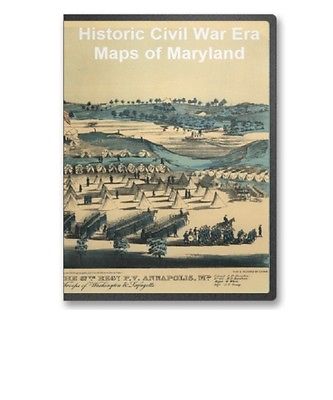
This CD contains 60 rare antique maps and descriptive pages representing fascinating details about Maryland and its vicinity during the Civil War in MrSid format. This format allows you to see the entire map on your computer screen or drill down to see the smallest details. The original maps are often quite large, as much as 36" long or larger and quite detailed. With the MrSID software, you can manipulate the map to print the entire map in great detail or zoom into a portion of the map in full detail for viewing or printing. You could even bring the images to a local print shop to have the maps reprinted in their full size. (MrSID software is included on the CD.)
To give you a sample of the detail you can expect in these maps, here is an example based on a panoramic map of Washington, DC.
The table below shows the and a small image of each map on this fascinating civil war history CD.
Part of map of portions of the milit'y dept's of Washington, Pennsylvania, Annapolis, and north eastern Virginia / compiled in the Bureau of Topographical Eng'rs, War Department &c. Washington, D.C. Oct. 6th, 1862 ; copied in Engr. Bureau C.S.A. Sept. 6th, 1864 by Wm. L. Sheppard, Dftsmn. ; forwarded to Lieut. Genl. J.A. Early Sept. 6th 1864. United States. Topographical Bureau. NOTES Relief shown by hachures. Shows Washington D.C. region, including western part of Maryland and northeastern Virginia. Does not show Pennsylvania with the exception of Gettysburg. Birds' eye view of the camp of the 67th Reg't P.V. Annapolis, Md. : on the ground occupied by the troops of Washington & Lafayette / pub'd & designed by Edwin Rees. Rees, Edwin. CREATED/PUBLISHED Philadelphia : Edwin Rees, 1863 (Philad elphi a : Lith'd by L. Rosenthal) NOTES "Entered according to act of Congress in the year 1863, by Edwin Rees, in ... the Eastern Dis't of Penn'a." Includes list of military officers' names. Parole Camp Annapolis, M'd. E. Sachse & Co. CREATED/PUBLISHED Balt im o re : Lith. by E. Sachse & Co., 1864 NOTES Bird's-eye view. "Entered according to Act of Congress in the year 1864 by E. Sachse & Co. in ... the District Court of Md." Includes index to points of interest. The field of Antietam. Wells, Jacob. CREATED/PUBLISHED S.l., 1886 NOTES Scale ca. 1:48,500. From Century illustrated monthly magazine, v. 32, June 1886. p. 290. Shows batteries, troop positions and movements, names of commanders, roads, street pattern of Sharpsburg, drainage, vegetation, relief by hachures, houses, names of residents, and fences. Chronology of events appears below the map. The Battle of Antietam, September 17, 1862. United States. National Park Service. CREATED/PUBLISHED Washington, U.S. Govt. Print. Off., 1968. NOTES Scale not given. Shows the placement and movement of troops during 3 phases of the battle. Northwest, or no. 1, sheet of preliminary map of Antietam (Sharpsburg) battlefield. Enlarged from the "Michler" map of the war records atlas with corrections and additions Antietam Battlefield Commission sic Maj. Geo. B. Davis. U.S.A., President, H. Heth, E. A. Carman, Expert Historian, and Jed. Hotchkiss, Expert Topographer. Antietam Battlefield Board. CREATED/PUBLISHED Washington, D.C., The Norris Peters Co., photo-litho., 1894. NOTES Scale ca. 1:10,400. Southwest, or no. 2, sheet of preliminary map of Antietam (Sharpsburg) battlefield. Enlarged from "Michler" map of the war records atlas with corrections and additions Antietam Battlefield Commission sic Maj. Geo. B. Davis, U.S.A., President, H. Heth, E. A. Carman, Expert Historian, and Jed. Hotchkiss, Expert Topographer. Antietam Battlefield Board. CREATED/PUBLISHED Washington D.C., The Norris Peters Co., photo-litho., 1895. NOTES Scale ca. 1:10,400. Antietam battlefield. Preliminary map no. 3. Hotchkiss, Jedediah, 1828-1899. CREATED/PUBLISHED Washington, D.C., Jed. Hotchkiss, The Norris Peters Co., photo-litho. 1895 NOTES Scale ca. 1:5,040. Detailed map of the battlefield showing roads and lanes, fences, houses, names of residents, crops, woodland, and relief by hachures. Troop positions are not noted. Antietam national battlefield site, Maryland Drawn by John J. Black, November 1948. United States. National Park Service. CREATED/PUBLISHED S.l. , reprint 1959. NOTES Scale ca. 1:54,000. Map indicates the main battle lines and the tour route. Inset: Vicinity map. 5 x 6 cm. Illustrates a descriptive leaflet by the U.S. National Park Service entitled "Antietam national battlefield site, Maryland." Antietam Battlefield. United States. National Park Service. CREATED/PUBLISHED Washington, U.S. Govt. Print. Off., 1972. NOTES Scale ca. 1:24,000. Antietam / National Park Service, U.S. Department of the Interior. United States. National Park Service. CREATED/PUBLISHED Washington : The Service, 1980 NOTES Scale ca. 1:31,680. Map of Antietam National Cemetary at Sharpsburg, Maryland Designed by A. A. Biggs, M. D., President & Genl. Supt., Sharpsburg, 1866. Surveyed and drawn by Chas. P. Kahler, C. E., Baltimore. Kahler, Charles P. CREATED/PUBLISHED Balto., Lith. by A. Hoen & Co., 1867. NOTES Scale 1:600. 29 "references" are keyed by number to the map. Map of the battlefield of Antietam, prepared by Lieut. Wm. H. Willcox, Top. Off. & A.A.D.C. on Brig. Genl. Doubleday's staff. Sept. 17, 1862 . Willcox, William H. CREATED/PUBLISHED Philada., Lith. of P. S. Duval & Son, 1862 NOTES Scale ca. 1:13,300. Handwritten inscription in the upper right-hand corner reads "Lieut Crawford with compts of Lt. Wm. H. Willcox." Shows roads and streets, houses, fences, vegetation, drainage, hachures, and troop positions. Inset: Map of the environs of Sharpsburg 12 x 10 cm. Map of the battlefield of Antietam, Sept. 17, 1862 prepared by Lieut. Wm. H. Willcox, Top. Off. & A.A.D.C. on Brig. Genl. Doubleday's staff, 3d edition. Willcox, William H. CREATED/PUBLISHED Philada., Lith. of P. S. Duval & Son, 1862 NOTES Scale ca. 1:13,300 . Inscribed in longhand as follows: Obtained from Washington & presented to Gen. R. E. Lee by J. E. B. Stuart. Battle of the Antietam fought September 16 & 17, 1862 Reconnoissance of the ground occupied by the 1st Army Corps commanded by Maj. Gen. Hooker. Made under the direction of Maj. D. C. Houston, Chf. Engr., by Lieut. W. A. Roebling and W. S. Long, C.E. Roebling, Washington A. CREATED/PUBLISHED S.l., 1862 NOTES Scale 1:10,560. Pen and ink manuscript drawn on tracing cloth, showing "line of Hooker's advance," roads, houses and names of occupants, fences, vegetation, drainage, and relief by hachures. Troop positions are not given. Antietam Sharpsburg and vicinity. Constructed and engraved to illustrate "The war with the South" Compiled by Charles Sholl Engd. by Rae Smith. Sholl, Charles CREATED/PUBLISHED New York, c1864. NOTES Scale ca. 1:26,700. Caption in lower margin: A topographical map of the battle field at Antietam from an actual survey by an engineer officer on General Doubleday's staff. Antietam. Prepared by Bvt. Brig. Genl. N. Michler, Major of Engineers, from surveys under his direction, by order of Brig. Genl. & Bvt. Maj. Genl. A. A. Humphreys, Chief of Engineers, and under the authority of the hon. Secretary of War. Surveyed & drawn by Maj: J. E. Weyss, assisted by F. Theilkuhl, J. Strasser & G. Thompson. Michler, N. (Nathaniel), 1827-1881. CREATED/PUBLISHED S.l. , Photo-lith. by the N.Y. Lithographing, Engraving & Printing Co., Julius Bien, Supt., 1867. NOTES Scale 1:21,120. "General direction of Confederate line of battle, Sept. 16th 1862" and "(General direction of) Confederate line of battle, Sept. 17th 1862 (evening)" are hand-colored in red. Union troop positions are not indicated. Detailed map of the environs of Sharpsburg showing roads, the "Washington Co. R.R.," fences, houses, names of residents, vegetation, drainage, villages, the "Burnside Bridge," "Bloody Lane," "Dunker's Chapel," "National Cemetery," and relief by hachures. Antietam. Enlarged and corrected from map of Gen. Michler, U.S. Eng., by Oliver C. Gould, Portland, Maine. Gould, Oliver C. CREATED/PUBLISHED S.l., 189-? NOTES Scale not given. "No. 1 = Confeds. opposing 10 Me. & 128 P.V., 7:30 to 8:00 A.M. No. 2 & 3 = Confeds. marching behind no. 1." Map of the battlefield of Antietam. No. 1. This map shows the position of the Union and Confederate forces on the morning of Sept. 17th, 1862, prior to the battle of Antietam which opened at daybreak Drawn under the direction of Antietam Board, Col. John C. Stearns, Gen. H. Heth. Theo. Friebus, Jr. Antietam Battlefield Board. CREATED/PUBLISHED Washington, D.C., Norris Peters Co., photo-litho., 1893. NOTES Scale 1:14,080. Confederate forces are shown in red and Union forces in blue. Headquarters of McClellan and Lee are clearly indicated. Legend lists the names of the corps, division, and brigade commanders. Brigades are keyed by number of positions on the map. Shows roads, railroad, houses, fences, names of residents, "Burnside Bridge," "Bloody Lane," "Dunker's Chapel," "National Cemetery," towns, vegetation, drainage, fords, and relief by hachures. Map of the battlefield of Antietam. This map shows the position of each of the forty-two different commands of the regular army engaged in the battle of Antietam, September 17, 1862. Battery "G", 2d U.S. Artillery, Lt. J. H. Butler, commanding, was not engaged in the battle, being attached to Gen'l. Couch's Division, near Harper's Ferry Drawn under the direction of Antietam Board, Col. John C. Stearns, Gen. H. Heth. Theo. Friebus Jr. Antietam Battlefield Board. CREATED/PUBLISHED Washington D.C., Norris Peters Co., photo-litho., 1893. NOTES Scale 1:14,080. Legend lists Union commands and the names of the commanders. Each unit is keyed by number to a position on the map. Confederate positions are not indicated. Shows roads, railroad, houses, fences, names of residents, "Burnside Bridge," "Bloody Lane," "Dunker's Chapel," "National Cemetery," towns, vegetation, drainage, fords, and relief by hachures. (No. 2) Map of the battlefield of Antietam Drawn under the direction of Antietam Board, Col. John C. Stearns and Gen. H. Heth. Antietam Battlefield Board. CREATED/PUBLISHED Washington, D.C. The Norris Peters Co., photo-litho. 1894. NOTES Scale 1:14,908. Map of the battlefield showing roads and lanes, houses and names of residents, fences, drainage, woodland, and relief by hachures. Troop positions are not indicated. Map of the battlefield of Antietam Published under the direction of Daniel S. Lamont and Russell A. Alger, Secretaries of War, by the Antietam Battlefield Board, Major Geo. W. Davis, U.S.A. President, General E. A. Carman, late Union army, and General H. Heth, late Confederate army. Surveyed and drawn by Col. E. B. Cope, Engineer and H. W. Mattern, Ass't Engineer, Gettysburg National Park. Antietam Battlefield Board. CREATED/PUBLISHED S.l. Antietam Battlefield Board 1898. NOTES Scale ca. 1:10,560. "Note: Figures in black and crosses, thus (+) marked along roadsides indicate numbers of tablets. For legends on tablets showing positions of troops and their movements, see final report of the Antietam Battlefield Board to the Secretary of War, dated 1898." Detailed map of the battlefield showing roads, lanes, fences, houses, names of residents, woodland, and relief by contour lines at intervals of 10 feet. Troop positions are not noted. Map of the battlefield of Antietam. CREATED/PUBLISHED S.l., 19--? NOTES Scale ca. 1:5280 (about 12 inches equals 1 mile, not "10 in. = 1 mile"). Very detailed anonymous and undated map of the battlefield indicating roads and lanes, drainage, houses, names of residents, grass fields, stubble, corn fields, plowed fields, rock outcrops, rail, post and rail, stone, and pailing fences, "fence s , kind unknown," hay stacks, and woodland. Relief is depicted by contour lines at intervals of 10 feet. Troop positions are not noted. Map of the battlefield of Antietam with the locations of monuments erected by the Commonwealth of Pennsylvania to the 3rd, 4th, 7th, 8th regiments of infantry, Pennsylvania Reserve Corps Prepared for Antietam Battlefield Commission of Pennsylvania. Reduced and drawn by S. A. Hammond, Ass't. Eng. Antietam Battlefield Memorial Commission. CREATED/PUBLISHED S.l., 1908? NOTES Scale 1:18,000. Detailed map indicating roads, drainage, fence lines, houses, names of residents, woodland, and relief by contour lines. Inset: Mansfield Avenue enlarged to show positions of Pennsylvania Reserve monuments. 7 x 25 cm. Map of the battlefield of Antietam with the locations of monuments erected by the Commonwealth of Pennsylvania Prepared for the Antietam Battlefield Memorial Commission. Reduced and drawn by S. A. Hammond, Asst. Eng. Antietam Battlefield Memorial Commission. CREATED/PUBLISHED N.Y., Julius Bien & Co., lith., 1908? NOTES Scale 1:18,000. Detailed map indicating roads, drainage, fence lines, houses, names of residents, woodland, and relief by contour lines. Battlefield monuments are located by red squares. Antietam Battlefield : new 1972 / National Park Service, U.S. Department of the Interior. United States. National Park Service. CREATED/PUBLISHED Washington : The Service, 1978 NOTES Scale ca. 1:23,500. Military map, Baltimore Co., Md. Compiled from the best authorities and corrected by actual survey under the direction of Col. W. F. Raynolds A.D.C., Chief Eng. 8th Army Corps. Drawn and lithographed in the office of the Chief Eng., 8th Army Corps, by Geo. Kaiser, Pvt. 10th N.Y. Vols. Kaiser, George. CREATED/PUBLISHED S.l. , 1863. NOTES Scale 1:63,360. Detailed map indicating forts, camps, military hospitals, roads, toll gates, railroads, towns, mills, houses and names of residents. The names of a few towns are underscored in red or blue. Map of Carroll County, Md. Entered according to act of Congress in the year 1863 by W. O. Shearer in the clerk's office of the district court of the eastern district of Pennsylvania. Shearer, W. O. CREATED/PUBLISHED Philadelphia? , c1863. NOTES Scale 1:31,600. "Made for military purposes only." Relatively crude hand-colored lithographic map showing roads and railroads, tow|
|
|