Welcome,
Guest! Login
Login
0 Items
$0.00
$0.00


Login to enter your own
review of this item.
 The Historical Archive is dedicated to creating a large, robust library of DVD and CD based products covering a wide range of significant and interesting historical events and cultural moments through film, photos, audios, maps and other documents. This growing collection of unique, special interest DVDs and CDs covers the full range of significant events that have shaped our culture, entertainment values and history.
Center total is the Seller's overall score, averaged from each active component:
|
Atomic Mall Feedback: Imported Feedback: Order Fulfillment Rate: |
100.0 99.8 100 | |
| Trophies Earned | ||
|
|

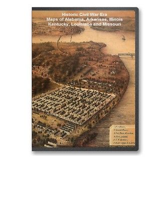
This CD contains 57 rare historic maps and descriptive pages representing fascinating details about Alabama, Arkansas, Illinois, Kentucky, Louisiana and Missouri and its vicinity during the Civil War in MrSid format. This format allows you to see the entire map on your computer screen or drill down to see the smallest details. The original maps are often quite large, as much as 36" long or larger and quite detailed. With the MrSID software, you can manipulate the map to print the entire map in great detail or zoom into a portion of the map in full detail for viewing or printing. You could even bring the images to a local print shop to have the maps reprinted in their full size. (MrSID software is included on the CD.)
To give you a sample of the detail you can expect in these maps, here is an example based on a panoramic map of Washington, DC.
The table below shows the and a small image of each map on this fascinating civil war history CD.
Alabama
Rebel line of works at Blakely captured by the Army of West Miss., April 9, 1865 Position & approaches by the Union forces. . United States. Army. Corps of Engineers. CREATED/PUBLISHED S.l. , Engraved in the Engineer Dept., 1865 NOTES Scale 1:14,400. Union positions are colored blue, and Confederate works are red. Includes roads, vegetation, drainage, and relief by hachures. Approaches to Mobile, Ala. 1864. . United States Coast Survey. CREATED/PUBLISHED S.l., 1864 NOTES Scale ca. 1:205,000. Map of Mobile Bay showing forts, towns, soundings, and a few roads. derived from published bibliography. Chart showing the entrance of Rear Admiral Farragut into Mobile Bay. 5th of August 1864 Drawn & compiled by Robt. Weir, for Rear Admiral D. G. Farragut, Novr. 1st 1864. . Weir, Robert, 1836-1905. CREATED/PUBLISHED N.Y. Lith. by Hatch & Co. 1864 NOTES Scale ca. 1:22,500. Detailed map showing five positions and the tracks of the vessels during the sea battle, obstructions, channels, banks, and shoals. Includes small views of the "Iron-clad Tennessee," Federal ship colliding with the Ram Tennessee, a vessel sailing past what appears to be Mobile Point, and a general view of the battle. Inset: Diagram showing points of collision of different vessels upon the Ram Tennessee . 19 x 15 cm. Plan of the battle of August 5, 1864. Mobile Bay . CREATED/PUBLISHED S.l., 1864 NOTES Scale not given. From Harper's weekly, v. 8, Sept. 24, 1864. p. 613. Names of ships are keyed by number and letter to the left of the map. Map of the defences of the city of Mobile. 1862-64 Engraved in the Engineer Bureau, War Dept. . United States. Army. Corps of Engineers. CREATED/PUBLISHED Philada., Bowen & Co. lith., 1866 NOTES Scale not given. From 39th Cong., 1st Sess. 1866 -Report of the Chief Engineer, U.S.A. No. 10. Map of Mobile and environs, showing roads, "Mobile and Ohio Rail-Road," drainage, vegetation, hachures, and fortifications at Blakely and Spanish Fort and those built in 1862, 1863, and 1864 at Mobile. Rebel defences, Mobile, Alabama, occupied by Union forces under Maj. Gen. E.R.S. Canby comdg. Engraved in the Engineer Department. S. Geismar, lith. . United States. Army. Corps of Engineers. CREATED/PUBLISHED Philada., Bowen & Co. lith., 1866 NOTES Scale ca. 1:18,200. From 39th Cong., 1st Sess. 1866 -Report of the Chief Engineer, U.S.A. No. 9. Map shows the three lines of fortifications constructed in 1862, 1863, and 1864, streets, "Mobile and Ohio Rail Road," vegetation, drainage, and relief by hachures. Most of the streets are not named. Siege operations at Spanish Fort, Mobile Bay, by the U.S. forces under Maj. Gen. Canby. Captured by the Army of West Miss. on the night of April 8 & 9, 1865. Major M. D. McAlester, Senior Engr., Major J. C. Palfrey, Asst. Engr., Capt. C. J. Allen, Asst. Engr., Capt. Patten, Inspector Genl's. Dept., Vol. Asst. Engr. Engraved in the Engineer Department. . McAlester, Miles D. CREATED/PUBLISHED Philada., Bowen & Co. lith., 1866 NOTES Scale ca. 1:16,600. From 39th Cong., 1st Sess. 1866 -Report of the Chief Engineer, U.S.A. No. 8. At head of title: Plan no. 8. Detailed map showing entrenchments, number, type, and position of Federal guns, vegetation, drainage, roads, and relief by hachures. Military map no. 54, prepared as basis for additional surveys prepared under direction of Capt. P. C. Hains, U.S.A., Act. Chief, Engineer Dept. of the Gulf. Drawn for stone by Helmuth Holtz. . Hains, Peter C. (Peter Conover), 1840-1921. CREATED/PUBLISHED S.l. , Printed by W. Pro bert, 1864? NOTES Scale 1:380,160. General map of southern Alabama and West Florida showing roads, railroads, towns, drainage, and a few names of residents along the Tensaw River. derived from published bibliography. Map is incomplete; the bottom border is missing. DLC Northern Alabama and Georgia Compiled and engraved at the U.S. Coast Survey Office, from state maps, postoffice maps, local surveys, military reconnoissance and information furnished by the U.S. Engineers attached to the Military Division of the Miss. Drawn by A. Lindenkohl. . CREATED/PUBLISHED S.l. , H. Lindenkohl & Chas. G. Krebs, lith., 1864? NOTES Scale 1:633,600. Signed in ink in upper margin: Llewellyn F. Haskell, Lt. Col., 7 U.S.C.I. July 15, 1864. DLC General map of northeastern Alabama and northwestern Georgia indicating cities and towns, roads and railroads, rivers, and some relief by hachures. Map overprinted in red to highlight state boundaries and railroads. Part of northern Georgia : no. 2 / compiled under the direction of Capt. Wm. E. Merrill, chief, Top'l Eng'r, D.C. . Merrill, W. E. (William Emery), 1837-1891. CREATED/PUBLISHED Washington, D.C.? : s.n., 1864 NOTES Covers a portion of northwestern Georgia and adjacent Alabama to the west of Atlanta. Annotated in blue pencil in upper margin: Specimen of field maps used in Sherman's campaigns, 1864. DLC Relief shown by hachures. Southern Mississippi and Alabama : showing the approaches to Mobile / Coast Survey Office, A.D. Bache, supt. . United States Coast Survey. CREATED/PUBLISHED Washington, D.C. : The Office, 1863. NOTES Covers the area west to east, from Jackson, Miss. to Montgomery, Ala. and north to south, from Philadelphia, Miss./Centreville, Ala. to Gulf of Mexico. Northern Mississippi and Alabama Compiled and engraved at the U.S. Coast Survey Office, from state maps, post office maps, local surveys, etc., with additions from campaign maps and information furnished by Capt. O. M. Poe, Chief Engineer, Military Division of the Mississippi and by Capt. W. E. Merrill, Chief Engineer, Department of the Cumberland. Drawn by A. Lindenkohl. . CREATED/PUBLISHED S.l., H. Lindenkohl & Chas. G. Krebs, lith. , 1864. NOTES Scale 1:633,600. General map indicating cities and towns, roads and railroads, rivers, and some relief by hachures. The map is overprinted in red to show state names and highlight state boundaries and railroads. Northern Mississippi and Alabama Drawn by A. Lindenkohl. H. Lindenkohl & Chas. G. Krebs, lith. . CREATED/PUBLISHED S.l. , U.S. Coast Survey, A. D. Bache, Supdt., 1865. NOTES Scale 1:633,600. General map, without title. State names, boundaries, and railroads are colored red.Arkansas
Approaches to Fort Hindman, Arkansas Post, on the Arkansas River : captured by the U.S. Mississippi Squadron, under command of Act'g. Rear Admiral David D. Porter, U.S.N., January 11th, 1863 / surveyed by C. Fendall, sub. assistant, U.S. Coast Survey, acting under orders of Rear Admiral D.D. Porter ; U.S. Coast Survey, A.D. Bache, supdt.; autographic transfer, J.W. Maedel. . Fendall, C. CREATED/PUBLISHED Washington, D.C. : The Survey, 1863. NOTES Annotated in pencil on verso: Approaches to Fort Hindman, Arkansas River, January 11, 1863. DLC Shows Fort Hindman and adjacent areas of the Arkansas River. View of Fort Hindman, Arkansas Post. January 11, 1863 . United States. Navy. CREATED/PUBLISHED S.l. , 1863 NOTES Scale ca. 1:2,450. From Report of the Secretary of the Navy, with an appendix, containing reports from officers. December, 1863 (Washington, Government Printing Office, 1863). fol. p. 414. Inset: Appearance of IX-gun silenced by the "Cincinnati." Map of the battlefield of Pea Ridge, Arkansas, showing the positions of the United States and Confederate forces on the 8th of March 1862 From a map forwarded to the Engineer Department Sept. 11th 1865 by Brevet Brig. Gen. C. B. Comstock A.D.C. . United States. Army. Corps of Engineers. CREATED/PUBLISHED Washington , 1876. NOTES Scale not given. Shows relief by hachures, drainage, vegetation, and houses. Map of Louisiana & Arkansas. Prepared under direction of 1st Lieut. Wm. Hoelcke, 39 U.S. Infty, acting Chief Engineer at hd. qts. Dept. of La., by Helmuth Holtz. . CREATED/PUBLISHED S.l., 1864? NOTES Scale ca. 1:650,000. At head of title: Department of Louisiana. General map showing roads, railroads, drainage, names and boundaries of counties, towns, forts, "military road to Memphis," and camp sites in St. Francis County, Ark. On August 2, 3, and 6, 1864.Illinois
Rock Island Barracks, Ill. Lith. C. Vogt. H. Lambach sct., Davenport Io. . Speidel, C. CREATED/PUBLISHED Rock Island, Ill., C. Speidel, 1864. NOTES Scale not given. "Print, by J. McKittrick & Co., St. Louis Mo." Perspective drawing of the prison for Confederate soldiers at Rock Island. Principal buildings and features are listed and keyed by number to the appropriate position in the view. Plan of a fort opposite Paducah, Ky. . CREATED/PUBLISHED 1864 NOTES Shows the environs of the proposed fort in Massac County, Illinois. In the lower right corner: Engr. Dept., July 18/64. recd. with Gen. Cullum's letter of the 16th inst. (C. 5621). Pen-and-ink, pencil, and watercolor. Includes a map of Paducah, Ky. Copy imperfect: Part of map in lower left missing Sketch and plan for a fortification opposite Paducah, Ky. . CREATED/PUBLISHED 1864 NOTES Shows sketch of the environs of the proposed fort in Massac County, Illinois. Relief shown by hachures. In the lower right corner: Engr. Dept., July 18/64. Recd. with Gen. Cullum's letter of the 16th inst. (C5621). Pen-and-ink and pencil. Includes plan and profile of the proposed fort. Copy imperfect: Part of profile in lower left missing Ohio River between Mound City and Cairo. Surveyed by the party of F. H. Gerdes, Asst., assigned by A. D. Bache, Supdt., U.S. Coast Survey, to act . Gerdes, F. H. CREATED/PUBLISHED S.l., 1864 NOTES Scale ca. 1:23,500. Indicates Fort Cairo, naval depot, and "harbor for powder barges" at Mound City, soundings in feet, roads and streets, and vegetation.Kentucky
Sketch of vicinity of head qtrs. U.S. forces, Snows Pond, Kentuckey sic . . CREATED/PUBLISHED 1862 NOTES Covers Florence area, west to Independence and east to Union, in central Boone County, Kentucky. Snows Pond not shown. Shows street names, houses, and names of residents. Military map of the vicinity of Frankfort, Kentucky / made by order of Brig. Gen. Q.A. Gillmore, Comd'g District of Central Kentucky, under direction of T.B. Brooks, Capt. Vol. Engr's. A.D.C., by J.H. Brooks, civil assistant to U.S. Topog. Engr's., February 1863. . Brooks, J. H. CREATED/PUBLISHED 1863 NOTES Shows streets, rivers and creeks, locations of the arsenal and "U.S. Hd. Qrs.," and recommended defensive positions. Annotated in blue pencil : Positions for defensive works proferred sic by Col. Gilbert with force and armament marked blue. Relief shown by hachures and spot heights. Sketch of the battlefield of Logan's Cross Roads and of the enemys fortified position at and opposite Mill Spring, Ky. to which he retreated after his defeat, Major General George H. Thomas comdg. the U.S. forces, General G. B. Crittenden comdg. the Confed. Forces, Jan. 19th 1862. Drawn under the direction of Capt. N. Michler, Topl. Engrs, U.S.A. and Edward Ruger. From a survey by Lt. Col. Hunten 1st Mich. Engrs. . Sketch of the battlefield of Logan's Cross Roads and of the enemys fortified position at and opposite Mill Spring, Ky. to which he retreated after his defeat, Major General George H. Thomas comdg. the U.S. forces, General G. B. Crittenden comdg. the Confed. Forces, Jan. 19th 1862. Drawn under the direction of Capt. N. Michler, Topl. Engrs, U.S.A. and Edward Ruger. From a survey by Lt. Col. Hunten 1st Mich. Engrs. Michler, N. (Nathaniel), 1827-1881. CREATED/PUBLISHED S.l. , Published by authority of the Hon. the Secretary of War in the office of the Chief of Engineers, U.S.A., 1877 NOTES Scale 1:15,840. Map of Logan's Cross Roads indicates four positions of Union and Confederate soldiers, troop camps, location of graves, roads, drainage, vegetation, houses, fences, and a few hachures. Map of Mill Spring shows Confederate entrenchments, roads, drainage, vegetation, hachures, houses and the names of residents. Eight-mile stretch of road between Longan's Cross Roads and Mill Spring is not shown. Plan of a fort opposite Paducah, Ky. . CREATED/PUBLISHED 1864 NOTES Shows the environs of the proposed fort in Massac County, Illinois. In the lower right corner: Engr. Dept., July 18/64. recd. with Gen. Cullum's letter of the 16th inst. (C. 5621). Pen-and-ink, pencil, and watercolor. Includes a map of Paducah, Ky. Copy imperfect: Part of map in lower left missing Map of the battlefield of Perryville, Ky. Major General Don Carlos Buell commanding the U.S. forces, General Braxton Bragg commanding the Confederate forces. October 8th 1862. Surveyed and compiled by order of Major General George H. Thomas U.S.A., by Edward Ruger and Anton Kilp. . Ruger, Edward. CREATED/PUBLISHED S.l. Published by authority of the Hon. the Secretary of War in the office of the Chief of Engineers, U.S. Army. 1877. NOTES Scale ca. 1:48,000. "Authorities: surveys by Edward Ruger and Anton Kilp and official reports of officers of both armies." Map gives "position of General Gilbert's corps on the evening of October 7th" and the positions of both the Union and Confederate troops "on the 8th before being brought into action," "while engaged," and "after dark on the evening of the 8th." Roads, the railroad from Lebanon to Stanford, drainage, vegetation, relief|
|
|