Welcome,
Guest! Login
Login
0 Items
$0.00
$0.00


Login to enter your own
review of this item.
 The Historical Archive is dedicated to creating a large, robust library of DVD and CD based products covering a wide range of significant and interesting historical events and cultural moments through film, photos, audios, maps and other documents. This growing collection of unique, special interest DVDs and CDs covers the full range of significant events that have shaped our culture, entertainment values and history.
Center total is the Seller's overall score, averaged from each active component:
|
Atomic Mall Feedback: Imported Feedback: Order Fulfillment Rate: |
100.0 99.8 100 | |
| Trophies Earned | ||
|
|

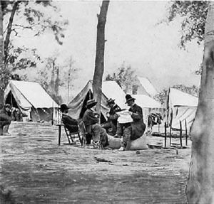
GENERAL ROBERT E. LEE'S first invasion of the North culminated with the Battle of Antietam, in Maryland (or Sharpsburg, as the South called it). The battle took place on Wednesday, September 17, 1862, just 18 days after the Confederate victory at Second Manassas, 40 miles to the southeast in Virginia.
Not only was this the first major Civil War engagement on Northern soil, it was also the bloodiest single day battle in American history.
To view the magnitude of the losses, consider that Antietam resulted in nine times as many Americans killed or wounded (23,000 soldiers) as took place on June 6, 1944--D-day, the so-called "longest day" of World War II. Also consider that more soldiers were killed and wounded at the Battle of Antietam than the deaths of all Americans in the Revolutionary War, War of 1812, Mexican War, and Spanish-American War combined.
The loss of human life at Antietam shocked both sides doing battle that day. And it nearly resulted in Lee's entire army, with its back to the Potomac River, being cut off from retreat across the Potomac (through Shepherdstown) and being captured by the stronger Union forces.
The battle also became a turning point, an engagement that changed the entire course of the Civil War. Antietam not only halted Lee's bold invasion of the North but thwarted his efforts to force Lincoln to sue for peace. It also provided Lincoln with the victory he needed to announce the abolition of slavery in the South. And with that proclamation of Emancipation, Lincoln was able to broaden the base of the war and may have prevented England and France from lending support to a country that engaged in human bondage. The battle sealed the fate of the Confederacy.
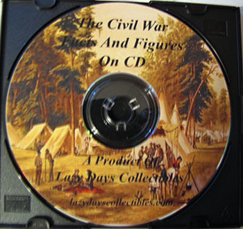
Below is detailed the contents of the CD.
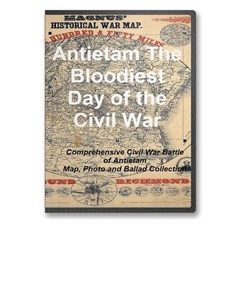
MAPSThis CD contains a large number of rare historic maps and descriptive pages representing fascinating details pertaining to the Battle of Antietam during the Civil War in MrSid format. This format allows you to see the entire map on your computer screen or drill down to see the smallest details. The original maps are often quite large, as much as 36" long or larger and quite detailed. With the MrSID software, you can manipulate the map to print the entire map in great detail or zoom into a portion of the map in full detail for viewing or printing. You could even bring the images to a local print shop to have the maps reprinted in their full size. (MrSID software is included on the CD.)
To give you a sample of the detail you can expect in these maps, here is an example based on a panoramic map of Washington, DC.
The table below shows the and a small image of each map on this fascinating civil war history CD.
The Battle of Antietam, September 17, 1862. United States. National Park Service. CREATED/PUBLISHED Washington, U.S. Govt. Print. Off., 1968. NOTES Scale not given. Shows the placement and movement of troops during 3 phases of the battle. Map of the battlefield of Antietam. No. 1. This map shows the position of the Union and Confederate forces on the morning of Sept. 17th, 1862, prior to the battle of Antietam which opened at daybreak Drawn under the direction of Antietam Board, Col. John C. Stearns, Gen. H. Heth. Theo. Friebus, Jr. Antietam Battlefield Board. CREATED/PUBLISHED Washington, D.C., Norris Peters Co., photo-litho., 1893. NOTES Scale 1:14,080. Confederate forces are shown in red and Union forces in blue. Headquarters of McClellan and Lee are clearly indicated. Legend lists the names of the corps, division, and brigade commanders. Brigades are keyed by number of positions on the map. Shows roads, railroad, houses, fences, names of residents, "Burnside Bridge," "Bloody Lane," "Dunker's Chapel," "National Cemetery," towns, vegetation, drainage, fords, and relief by hachures. Map of the battlefield of Antietam with the locations of monuments erected by the Commonwealth of Pennsylvania Prepared for the Antietam Battlefield Memorial Commission. Reduced and drawn by S. A. Hammond, Asst. Eng. Antietam Battlefield Memorial Commission. CREATED/PUBLISHED N.Y., Julius Bien & Co., lith., 1908? NOTES Scale 1:18,000. "Reduced by permission of the Antietam Commission, Brig. Gen. E. A. Carman, Commissioner, from their map of the battlefield that was surveyed and drawn by the engineers of the Gettysburg National Park Commission, Lt. Col. John P. Nicholson, Chairman, Bvt. Lt. Col. E. B. Cope, Engineer." Detailed map indicating roads, drainage, fence lines, houses, names of residents, woodland, and relief by contour lines. Battlefield monuments are located by red squares. Antietam Battlefield : new 1972 / National Park Service, U.S. Department of the Interior. United States. National Park Service. CREATED/PUBLISHED Washington : The Service, 1978 NOTES Scale ca. 1:23,500. Includes text and descriptive index to points of interest. (No. 2) Map of the battlefield of Antietam Drawn under the direction of Antietam Board, Col. John C. Stearns and Gen. H. Heth. Antietam Battlefield Board. CREATED/PUBLISHED Washington, D.C. The Norris Peters Co., photo-litho. 1894. NOTES Scale 1:14,908. Map of the battlefield showing roads and lanes, houses and names of residents, fences, drainage, woodland, and relief by hachures. Troop positions are not indicated. Map of the battlefield of Antietam Published under the direction of Daniel S. Lamont and Russell A. Alger, Secretaries of War, by the Antietam Battlefield Board, Major Geo. W. Davis, U.S.A. President, General E. A. Carman, late Union army, and General H. Heth, late Confederate army. Surveyed and drawn by Col. E. B. Cope, Engineer and H. W. Mattern, Ass't Engineer, Gettysburg National Park. Antietam Battlefield Board. CREATED/PUBLISHED S.l. Antietam Battlefield Board 1898. NOTES Scale ca. 1:10,560. "Drawn by H. W. Mattern" in the lower right corner. "Note: Figures in black and crosses, thus (+) marked along roadsides indicate numbers of tablets. For legends on tablets showing positions of troops and their movements, see final report of the Antietam Battlefield Board to the Secretary of War, dated 1898." Detailed map of the battlefield showing roads, lanes, fences, houses, names of residents, woodland, and relief by contour lines at intervals of 10 feet. Troop positions are not noted. Map of the battlefield of Antietam . This map shows the position of each of the forty-two different commands of the regular army engaged in the battle of Antietam, September 17, 1862. Battery "G", 2d U.S. Artillery, Lt. J. H. Butler, commanding, was not engaged in the battle, being attached to Gen'l. Couch's Division, near Harper's Ferry Drawn under the direction of Antietam Board, Col. John C. Stearns, Gen. H. Heth. Theo. Friebus Jr. Antietam Battlefield Board. CREATED/PUBLISHED Washington D.C., Norris Peters Co., photo-litho., 1893. NOTES Scale 1:14,080. Legend lists Union commands and the names of the commanders. Each unit is keyed by number to a position on the map. Confederate positions are not indicated. Shows roads, railroad, houses, fences, names of residents, "Burnside Bridge," "Bloody Lane," "Dunker's Chapel," "National Cemetery," towns, vegetation, drainage, fords, and relief by hachures. Map of the battlefield of Antietam with the locations of monuments erected by the Commonwealth of Pennsylvania to the 3rd, 4th, 7th, 8th regiments of infantry, Pennsylvania Reserve Corps Prepared for Antietam Battlefield Commission of Pennsylvania. Reduced and drawn by S. A. Hammond, Ass't. Eng. Antietam Battlefield Memorial Commission. CREATED/PUBLISHED S.l., 1908? NOTES Scale 1:18,000. "Reduced by permission of the Antietam Commission, Brig. Gen. E. A. Carman, Commissioner, from their map of the battlefield that was surveyed and drawn by the engineers of the Gettysburg National Park Commission, Lt. Col. John P. Nicholson, Chairman, Bvt. Lt. Col. E. B. Cope, Engineer, H. W. Mattern, Ass't. Engineer, and E. M. Hewitt, Ass't. Engineer." Detailed map indicating roads, drainage, fence lines, houses, names of residents, woodland, and relief by contour lines. Inset: Mansfield Avenue enlarged to show positions of Pennsylvania Reserve monuments. 7 x 25 cm. Antietam Battlefield. United States. National Park Service. CREATED/PUBLISHED Washington, U.S. Govt. Print. Off., 1972. NOTES Scale ca. 1:24,000. Includes text and index to points of interest. Antietam / National Park Service, U.S. Department of the Interior. United States. National Park Service. CREATED/PUBLISHED Washington : The Service, 1980 NOTES Scale ca. 1:31,680. Folded title: Antietam National Battlefield, Maryland. Relief shown by shading. Includes text, descriptive index to points of interest, and location map. / National Park Service, U.S. Department of the Interior. United States. National Park Service. CREATED/PUBLISHED Washington : The Service, 1980 NOTES Scale ca. 1:31,680. Relief shown by shading. Includes text, descriptive index to points of interest, and location map. Antietam Sharpsburg and vicinity. Constructed and engraved to illustrate "The war with the South" Compiled by Charles Sholl Engd. by Rae Smith. Sholl, Charles CREATED/PUBLISHED New York, c1864. NOTES Scale ca. 1:26,700. From Tomes, Robert. The war with the South. New York, Virtue & Yorston, 1862-1867, v. 2, between p. 426 and 427. Signed (facsim.): Charles: Sholl, Topl. Engineer. This issue lacks the copyright notice in the lower margin. Caption in lower margin: A topographical map of the battle field at Antietam from an actual survey by an engineer officer on General Doubleday's staff. Antietam Sharpsburg and vicinity. Constructed and engraved to illustrate "The war with the South" Compiled by Charles Sholl Engd. by Rae Smith. Sholl, Charles. CREATED/PUBLISHED New York, c1864. NOTES Scale ca. 1:26,700. From Tomes, Robert. The war with the South. New York, Virtue & Yorston, 1862-1867, v. 2, between p. 426 and 427. Signed (facsim.): Charles: Sholl, Topl. Engineer. "Entered according to act of Congress AD. 1864 by Virtue, Yorston & Co." Caption in lower margin: A topographical map of the battle field at Antietam from an actual survey by an engineer officer on General Doubleday's staff. Southwest, or no. 2, sheet of preliminary map of Antietam (Sharpsburg) battlefield. Enlarged from "Michler" map of the war records atlas with corrections and additions Antietam Battlefield Commission sic Maj. Geo. B. Davis, U.S.A., President, H. Heth, E. A. Carman, Expert Historian, and Jed. Hotchkiss, Expert Topographer. Antietam Battlefield Board. CREATED/PUBLISHED Washington D.C., The Norris Peters Co., photo-litho., 1895. NOTES Scale ca. 1:10,400. Map extends from Sharpsburg south to Antietam Iron Works and shows roads and lanes, houses and names of residents, fences, and drainage. Troop positions are not noted. Battle of the Antietam fought September 16 & 17, 1862 Reconnoissance of the ground occupied by the 1st Army Corps commanded by Maj. Gen. Hooker. Made under the direction of Maj. D. C. Houston, Chf. Engr., by Lieut. W. A. Roebling and W. S. Long, C.E. Roebling, Washington A. CREATED/PUBLISHED S.l., 1862 NOTES Scale 1:10,560. Pen and ink manuscript drawn on tracing cloth, showing "line of Hooker's advance," roads, houses and names of occupants, fences, vegetation, drainage, and relief by hachures. Troop positions are not given. Antietam national battlefield site, Maryland Drawn by John J. Black, November 1948. United States. National Park Service. CREATED/PUBLISHED S.l. , reprint 1959. NOTES Scale ca. 1:54,000. Map indicates the main battle lines and the tour route. Inset: Vicinity map. 5 x 6 cm. Illustrates a descriptive leaflet by the U.S. National Park Service entitled "Antietam national battlefield site, Maryland." The field of Antietam. Wells, Jacob. CREATED/PUBLISHED S.l., 1886 NOTES Scale ca. 1:48,500. From Century illustrated monthly magazine, v. 32, June 1886. p. 290. Shows batteries, troop positions and movements, names of commanders, roads, street pattern of Sharpsburg, drainage, vegetation, relief by hachures, houses, names of residents, and fences. Chronology of events appears below the map. Map of Antietam National Cemetary at Sharpsburg, Maryland Designed by A. A. Biggs, M. D., President & Genl. Supt., Sharpsburg, 1866. Surveyed and drawn by Chas. P. Kahler, C. E., Baltimore. Kahler, Charles P. CREATED/PUBLISHED Balto., Lith. by A. Hoen & Co., 1867. NOTES Scale 1:600. "Entered according to Act of Congress in the year 1867 by the Board of Trustees of the 'Antietam National Cemetary' in the Clerks Office of the U.S. District Court for Maryland." 29 "references" are keyed by number to the map. Map of the battlefield of Antietam, prepared by Lieut. Wm. H. Willcox, Top. Off. & A.A.D.C. on Brig. Genl. Doubleday's staff. Sept. 17, 1862 . Willcox, William H. CREATED/PUBLISHED Philada., Lith. of P. S. Duval & Son, 1862 NOTES Scale ca. 1:13,300. Handwritten inscription in the upper right-hand corner reads "Lieut Crawford with compts of Lt. Wm. H. Willcox." Shows roads and streets, houses, fences, vegetation, drainage, hachures, and troop positions. Inset: Map of the environs of Sharpsburg 12 x 10 cm. , prepared by Lieut. Wm. H. Willcox, Top. Off. & A.A.D.C. on Brig. Genl. Doubleday's staff. Sept. 17, 1862 . Willcox, William H. CREATED/PUBLISHED Philada., Lith. of P. S. Duval & Son, 1862 NOTES Scale ca. 1:13,300. Handwritten inscription in the upper right-hand corner reads "Lieut Crawford with compts of Lt. Wm. H. Willcox." Shows roads and streets, houses, fences, vegetation, drainage, hachures, and troop positions. Inset: Map of the environs of Sharpsburg 12 x 10 cm. Northwest, or no. 1, sheet of preliminary map of Antietam (Sharpsburg) battlefield. Enlarged from the "Michler" map of the war records atlas with corrections and additions Antietam Battlefield Commission sic Maj. Geo. B. Davis. U.S.A., President, H. Heth, E. A. Carman, Expert Historian, and Jed. Hotchkiss, Expert Topographer. Antietam Battlefield Board. CREATED/PUBLISHED Washington, D.C., The Norris Peters Co., photo-litho., 1894. NOTES Scale ca. 1:10,400. The Geography